Cameron Falls and the Ingraham Trail, the Road That Leads Nowhere on Purpose
A guide's day on the Ingraham Trail: the drive past Prosperous, Madeline and Prelude lakes, the Cameron Falls hike, and why this dead-end road becomes aurora country after dark.
 By Thomas Beaulieu, Yellowknife tour guide & northern lights specialist
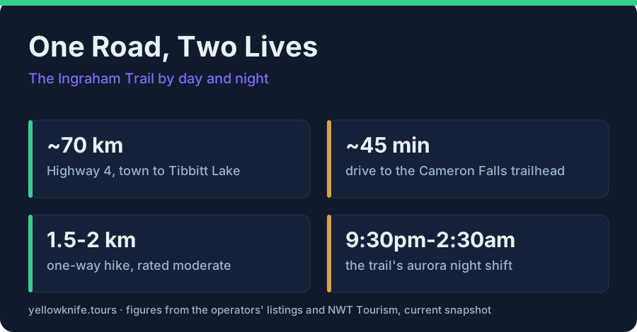
There is exactly one highway out of Yellowknife that does not eventually take you south, and it quits after about 70 kilometres in a gravel lot at Tibbitt Lake. That is the whole road. No town at the end, no ferry, nothing to connect to. The Ingraham Trail is a dead end by design, and it happens to be my favourite stretch of pavement in the territory, because I drive it in both of its lives: hiking country by day when I am off, aurora country by night when I am working.
What is the Ingraham Trail, and why would you drive a road to nowhere?
The Ingraham Trail is Highway 4, a roughly 70 km dead-end road running east from Yellowknife past a chain of lakes: Prosperous, Madeline, Prelude, then Cameron Falls, ending at Tibbitt Lake. It is the city's playground road, strung with trailheads, boat launches and, after dark, aurora viewpoints.
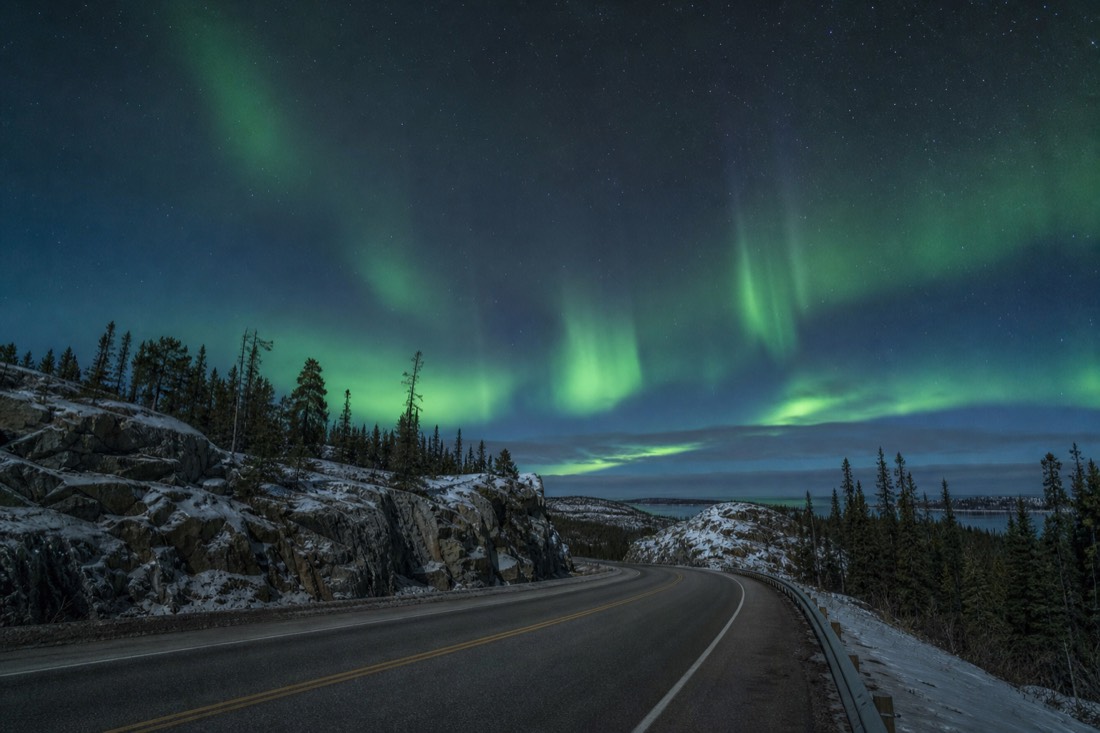
Locals rarely call it Highway 4. It is just "the trail," and the name fits, because the road feels less like infrastructure and more like a long path between lakes. Ten minutes out of town the houses stop, the Canadian Shield takes over, and the rest of the drive is granite, spruce and water in rotation. Every few kilometres a signed pullout appears, and each one is somebody's favourite spot.
The dead end is the point. Because the trail goes nowhere, nobody is passing through, and traffic thins to fishing trucks and canoe racks. In summer the lakes fill with paddlers and swimmers, part of the warm-season life I covered in Yellowknife in summer. In winter the same pullouts fill with tour vans hunting sky. Few roads anywhere work a double shift like this one.
| Stop, in order from town | What it is | Best for |
|---|---|---|
| Prosperous Lake | Big lake early on the trail | Boat launch, quick escapes from town |
| Madeline Lake | Smaller, calmer lake | Easy shore stops; a heated aurora lodge operates nearby in season |
| Prelude Lake | Large lake partway out | Classic summer swimming and paddling water |
| Cameron Falls trailhead (~46 km) | Hidden Lake Territorial Park | The trail's signature hike |
| Tibbitt Lake (~70 km) | End of the pavement's ambition | Turning around, feeling far from everything |
What do you need to know before you drive the Ingraham Trail yourself?
You need your own wheels or a tour van, because no bus runs the Ingraham Trail. Allow about 45 minutes each way to the Cameron Falls trailhead at roughly 46 km, more if the lakes slow you down, and carry repellent in June and July. Fuel and food come from town.
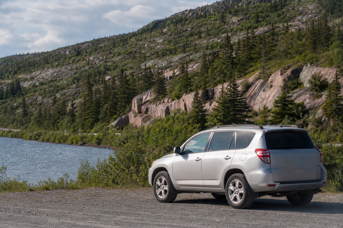
Rental desks sit at the airport: Hertz, Budget and National. That matters more here than most visitors expect, because every tour in town includes hotel pickup and the centre is walkable, so this highway is one of the few honest reasons to hold car keys at all. Winter rentals come winterized with plug-in block heaters, and leaving the car plugged in overnight is normal practice rather than a precaution, something I go through properly in renting a car in Yellowknife.
Treat the drive as a half day, not an errand. Prosperous Lake arrives while town still feels close. Madeline is the small quiet one. Prelude is where the paddlers and swimmers go, the falls trailhead comes up around 46 km, and the road finally gives up at Tibbitt Lake near the 70 km mark. Nobody drives it straight through, which is the point of it.
Two things catch first-timers. Bugs come first: near water in June and early July they are real, and repellent belongs in the door pocket, not at home. Then there is the fact that this is open country with animals in it, black bears included on summer trails, so the territory's own wildlife safety guidance is worth ten minutes before you go. Winter rewrites the whole road again: the hiking stops, the pullouts empty by day, the cold turns any breakdown serious, and the NWT's winter driving advice stops being boilerplate.
| Driving the trail | What to expect |
|---|---|
| The road | Highway 4, the Ingraham Trail, running east out of Yellowknife |
| Length | About 70 km to the dead end at Tibbitt Lake |
| To the falls trailhead | ~46 km, about 45 minutes without stops |
| Getting a vehicle | Rental desks at the airport: Hertz, Budget, National |
| Winter driving | Winterized rentals, plug-in block heaters, overnight plugging in is routine |
| Worst nuisance | Bugs near the water in June and early July |
| Public transport | None out this way: your own car or a tour van |
What is the Cameron Falls hike actually like?
A well-marked trail of about 2 km round trip through Shield country, rated moderate, reaching a broad waterfall on the Cameron River. The trailhead sits in Hidden Lake Territorial Park, roughly 46 km and 45 minutes from Yellowknife, and the hike is a summer and fall outing.
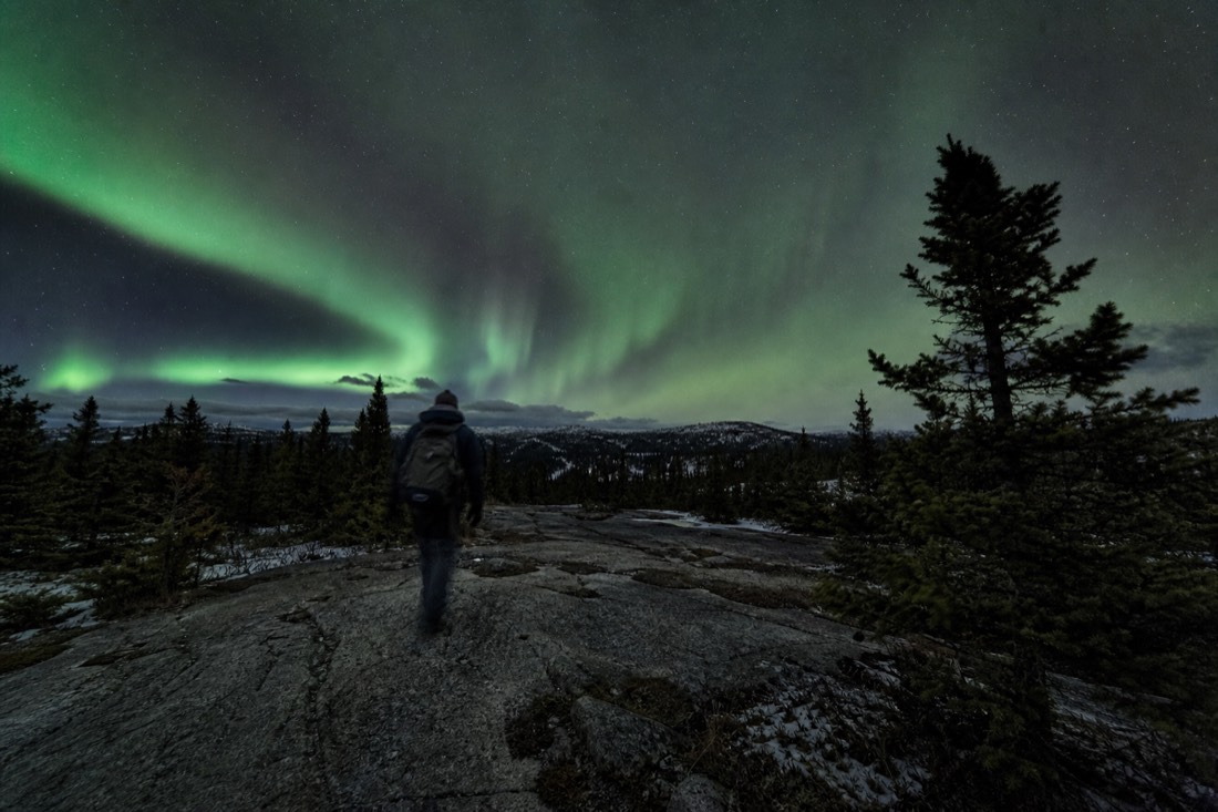
The walk is honest subarctic terrain: bare granite humps, boardwalk over the soft spots, roots and ledges that ask for real shoes rather than sandals. Moderate is the right word. Kids do it constantly, but you earn the falls with a bit of up and down rather than strolling to them.
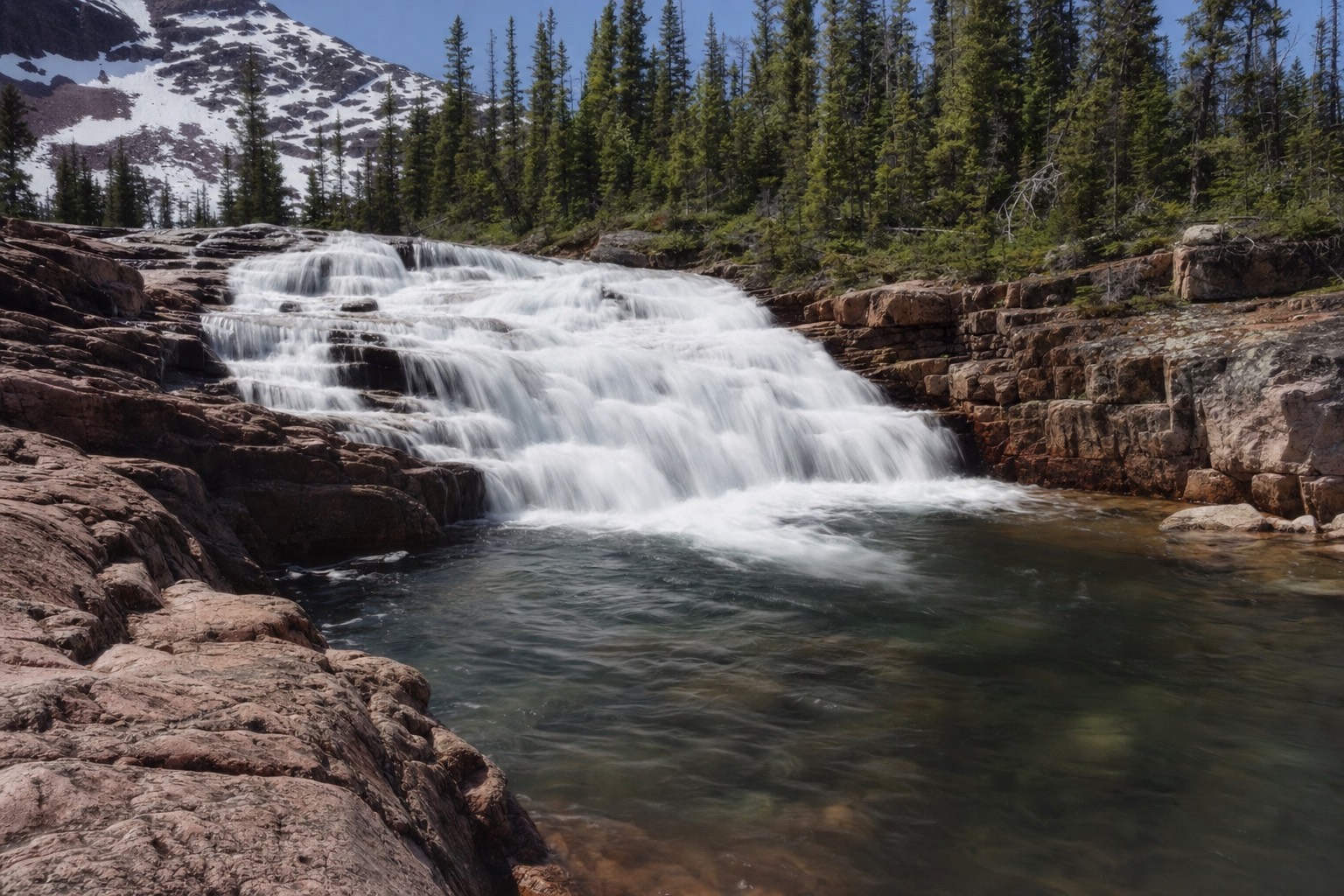
Then the sound arrives before the view, and you come out on rock ledges above a waterfall that pours wide over pink granite instead of plunging from a cliff. It photographs differently every month. Spring melt makes it thunder. Late summer thins it into braids you can study one at a time. The territory's own page on Cameron Falls calls it one of the most popular day trips in the area, and on a July weekend the trailhead lot backs that up. Go on a weekday morning and you may get the ledges to yourself, plus mosquitoes in June and early July, so bring repellent and mercy for your own ankles.
Two kilometres there and back can feel slight next to the drive you just made. When I have a whole day I keep going: the Cameron River Ramparts run roughly 8 to 9 km one way upstream from the falls, rougher and much less developed, a summer walk that turns the same trailhead into a proper outing. It sits at the ambitious end of the region's walking, which I set beside the easier options in Yellowknife's hiking trails.
| Cameron Falls hike | The facts |
|---|---|
| Round-trip distance | About 2 km |
| Difficulty | Moderate: granite, roots, some climbs |
| Season | Summer and fall |
| Drive from Yellowknife | ~46 km, about 45 minutes |
| Where it is | Hidden Lake Territorial Park, off the Ingraham Trail |
| Bring | Real shoes, water, bug spray in early summer |
Why do the aurora hunts drive this same road at night?
Because the trail solves the two problems every aurora chase has: light and cloud. It runs away from the city glow past a chain of dark lakes with flat, open horizons, and its length lets guides move between viewpoints until they find clear sky. By 10:30pm on a winter night, the trail changes owners.
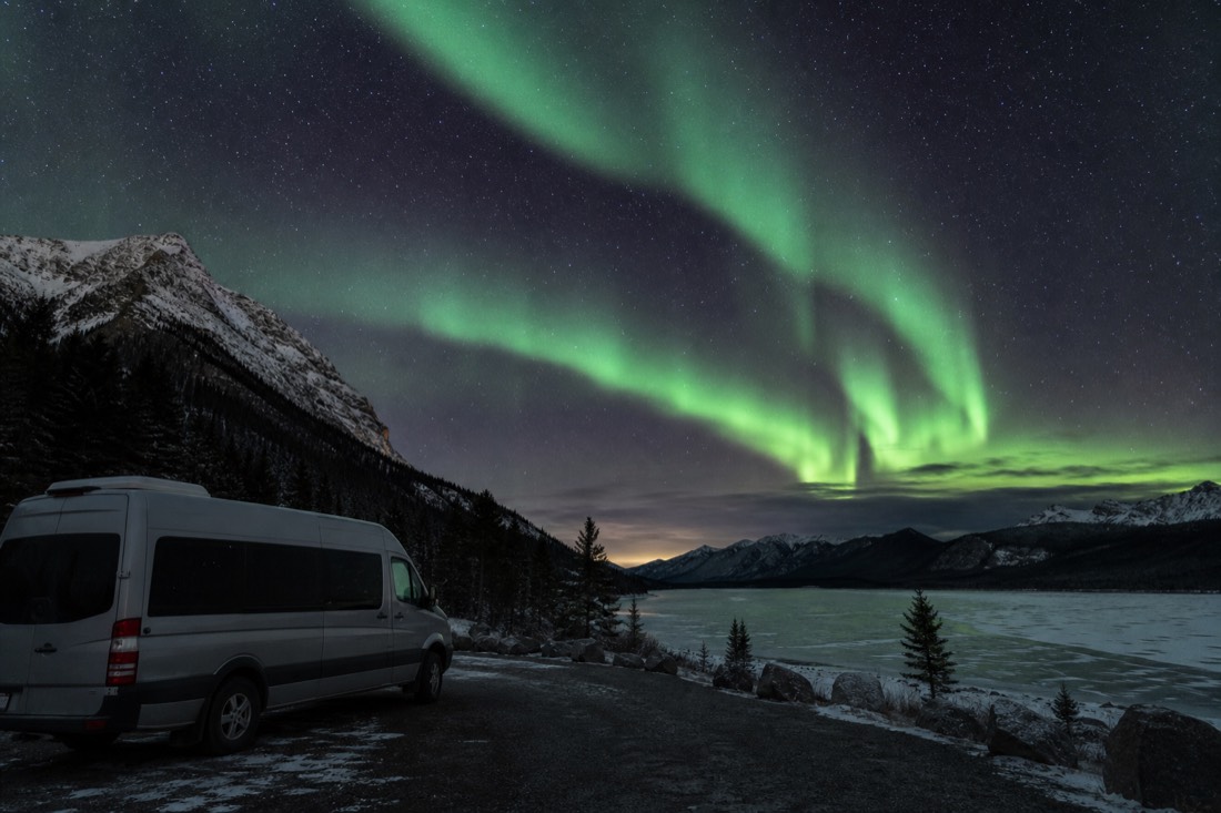
This is the part of the trail I know best, because it is my office. Aurora pickups run about 9:30 to 10:30pm, and within half an hour the vans are spaced out along the highway at their chosen lakes. A frozen lake is a natural observatory: walk out from the shore and the horizon drops flat in every direction, with nothing but sky from edge to edge. The hunts work up to three viewpoints a night, reading the cloud and relocating when a hole opens somewhere else down the road. Returns land between 1:30 and 2:30am, since the show tends to peak near local midnight. I wrote about the rhythm of those nights in what an aurora hunt is really like.
The trail hosts the parked style of viewing too. A heated lodge operates near Madeline Lake with games and WiFi between shows, and Aurora Village runs its teepee camp off this same highway. The chase-versus-camp decision is its own question, but if the moving hunt appeals, the northern lights tours page compares the local options and you can check live availability and prices for the flagship aurora hunt on Viator, the 4.8-rated chase with a photographer aboard and free photos included. The city's own aurora and weather page is frank about why the sky out here delivers so often.
Can you do the trail by day and the aurora by night in one visit?
Yes, and in autumn you can nearly do it in one day. Hike Cameron Falls in the afternoon, eat in town, then ride back out the same highway after 10pm with an aurora hunt. From mid-August to early October the lakes are still open water, and the lights reflect in them.
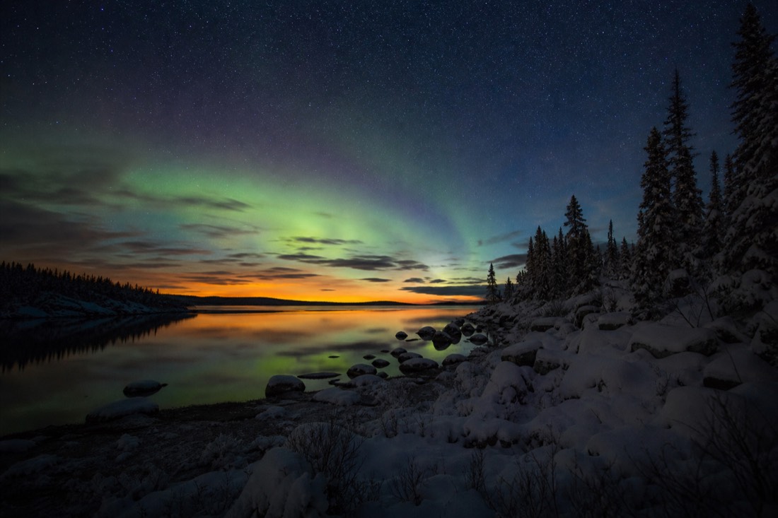
The double-shift day is my standard advice for September visitors. The hike is at its best, the bugs are gone, the birches turn gold against the pink granite, and the aurora season is already running over open water, which I covered in September aurora over open water. Winter visitors split the two lives differently: the falls hike drops off the menu once deep cold and snow arrive, but the night side of the trail hits its stride with the longest dark of the year.
| The trail's two lives | By day | By night |
|---|---|---|
| Season | Summer and fall for hiking | Mid-Aug to early Oct, mid-Nov to early Apr for aurora |
| Who is out there | Hikers, paddlers, anglers | Aurora hunts, lodge guests, photographers |
| The lakes' job | Swimming, boat launches, scenery | Flat dark horizons and, in autumn, reflections |
| Typical hours | Morning to late afternoon | Pickups ~9:30-10:30pm, returns ~1:30-2:30am |
| What decides the day | Weather and bugs | Cloud cover; guides relocate along the road to clear sky |
I have driven the trail in July with a canoe on the roof and in January with a van full of camera tripods, and it has never once felt like the same road twice. Go hike the falls while the granite is warm. Then, if the season is right, come back out after dark and watch the sky take over the far end of the highway.